GFS Forecast Model: Surface Temperature - Real-time
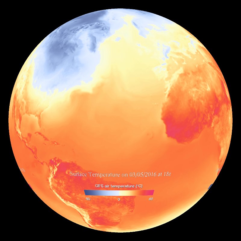
Temperature changes day to day can provide clues to a location's topography and climate, especially in the northern hemisphere winter.
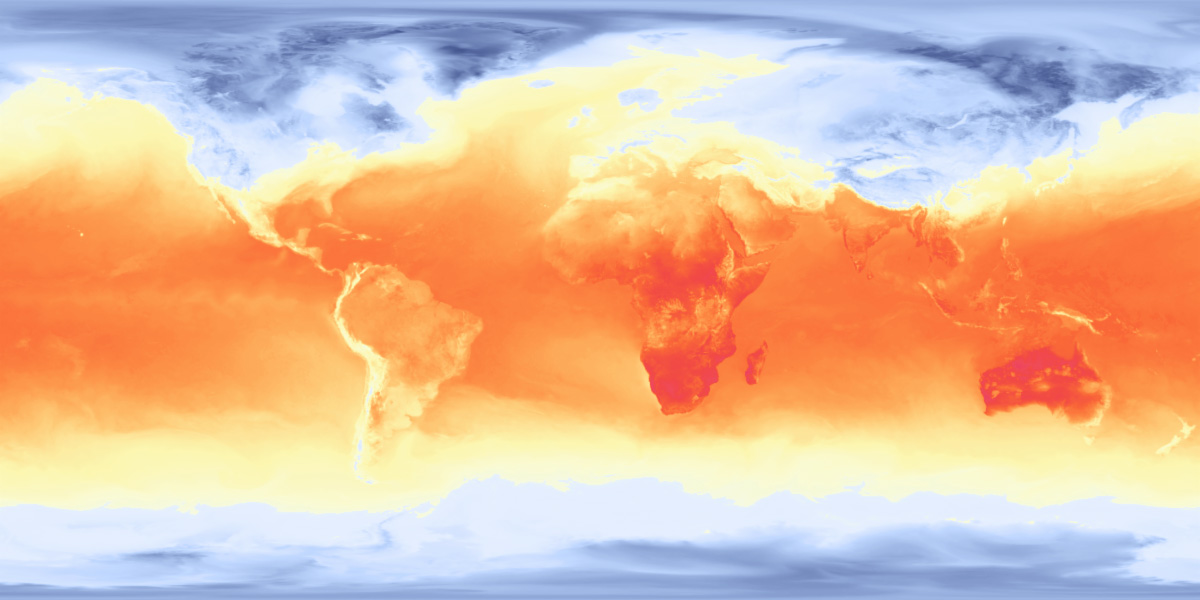
Daily temperature changes can reveal clues about a location’s landscape and climate—especially in winter in the Northern Hemisphere. In this lesson, students will compare an afternoon winter forecast to one in the middle of the night, exploring how temperatures shift over time and how these changes differ between inland areas and coastal regions.
What’s happening in this map? What do you notice that makes you think that?
In this short activity, students will strengthen their critical thinking skills by carefully observing the data, forming ideas, and backing them up with evidence.
While these maps do relate to weather, climate, and topography, the real goal of this activity is to help students slow down, look closely, ask better questions, and support their ideas with strong evidence. However, if you’re teaching a unit on weather, climate zones, or landforms, this could be a great addition to your lessons!
Temperature changes day to day can provide clues to a location's topography and climate, especially in the northern hemisphere winter.