 Science On a Sphere
Tsunami Locations - 1610 BCE - Present
Details
Permalink to Details- Added to the Catalog
- Available for
- SOS
- Categories
- Land: Plate Tectonics
- Water: Tsunamis
- Keywords
- Bathymetry
- Chile
- Disasters
- Earthquakes
- Eruptions
- Japan
- Landslides
- Oceans
- Ring of Fire
- Sumatra
- Tectonics
- Tsunamis
- Volcanoes
Description
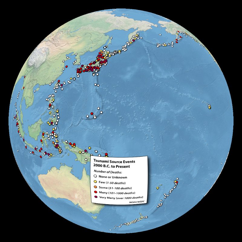
Permalink to DescriptionEarthquakes, landslides, volcanoes, explosions, and atmospheric processes - all of these disasters have caused tsunamis in the past. But by far, the most common generator of tsunamis is earthquakes, as has recently been seen in Sumatra, Chile, and Japan. NOAA's National Centers for Environmental Information (NCEI) archives academic and historical reports from around the world estimating where tsunamis originated, and has compiled a database of over 3100 events from approximately 1610 B.C.E. through the present. This image plots about half of those events - tsunamis that are classified as a "definite tsunami" or "probable tsunami" and are considered "oceanic tsunamis" (tsunamis originating in an ocean body rather than an inland river/lake). The icons are shaded according to the devastation of the event by the number of fatalities caused where white = none or unknown, yellow = 1-50, orange = 51-100, red = 101-1000, and purple >= 1001. The symbols are classified by the cause of the tsunami: circles = earthquakes (sized by magnitude), triangles = volcanic eruptions, squares = landslides, and question marks = unknown cause. In addition, plate boundaries are shown, classified as blue = convergent, red = divergent, and brown = transform. Since earthquakes are the most common tsunami generator, the highest density of event origins are located around the Pacific "Ring of Fire" known for its prevalence of volcanic and tectonic activity. The points are overlaid on top of a map of ocean bathymetry (Natural Earth 2 from the Natural Earth project), which indicates many of the pronounced ocean features, such as volcanic islands, rift zones, and plate boundaries that are often associated with generating tsunamis.
It should be noted that it is often difficult to validate the exact origin or cause of many ancient tsunamis, especially with the accuracy that is available with today's monitoring equipment. As a result, some tsunami origins seem landlocked. Many are due to coarse estimates of where a tsunami may have originated, or are associated with the closest city that recorded an event. Other tsunami datasets available for SOS include 2004 Indian Ocean Tsunami and 2011 Japan Tsunami.
Notable Features
Permalink to Notable Features- The highest density of tsunami origins is along the Pacific "Ring of Fire" due to high levels of earthquake activity, the most common trigger for tsunamis
- Only the events classified as "definite tsunami" and "probable tsunami" in the database were mapped, which totaled about 1200 of the 3100 events