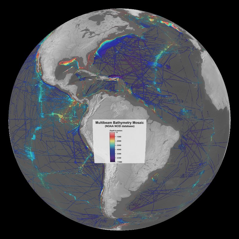
Beneath the sea surface is an amazing sea floor that contains mountain ranges, trenches and plains. The ocean covers 71% of the Earth's surface, has an area of 139,400,000 square miles and an average depth of 2.3 miles. The first measurements of the sea floor were made with weighted lines that were lowered until they hit the bottom. Vast improvements have been made since that time, yet the majority of the sea floor remains unmapped. It's important to know the bathymetry, or the sea floor terrain, of the ocean for navigation and exploration purposes. Today, bathymetric maps are created using data from multibeam echosounders. A multibeam echosounder is a device that is mounted to the hull of a ship to determine the depth of water and the nature of the seabed. The system emits a broad acoustic pulse from under a ship and then records how long it takes the beams to return to the ship after bouncing off the sea floor. If the speed of sound in water is known for the full water column, then the depth of the sea floor can be calculated from the travel time. Multiple beams are sent out in a fan shape to collect depth information in a swath beneath the boat as it travels through the ocean.
Included in this dataset is a layer of an all-blue color palette. If you prefer this palette, you can toggle it on along with the all-blue legend.
NOAA's National Centers for Environmental Information (NCEI) manages the United States national archive for multibeam bathymetric data and presently holds over 2600 bathymetric surveys received from sources worldwide, including universities, private industry and government organizations. This dataset is a "mosaic" of all bathymetric data in NCEI's archive of multibeam bathymetric surveys. The image is color-coded by depth (see the legend).