SOS Coordinate System
Details
Permalink to Details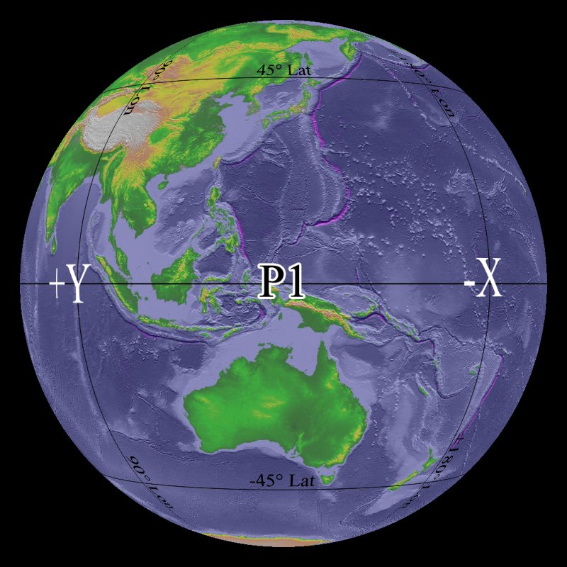
Description
Permalink to DescriptionThis dataset was created to help SOS users understand the layout of the exhibit space and how datasets will load on the sphere. Each of the four projectors covers one quadrant of the sphere. The P1, P2, P3, and P4, seen along the equator, label each of the projectors. Typically, the first projector, labeled P1, is closest to the computers and the remaining projectors are labeled in counter-clockwise order.
The prime meridian, which should be in the center of SOS datasets, loads between P3 and P4. The edges of the map load between P1 and P2. The lines of latitude and longitude are included to easily identify these locations. The image below is included to further show how datasets load in relation to the room. In addition, the axes of rotation used for the Wii remote are labeled as well. This dataset is a great resources for those learning how to use the Wii remote.
Notable Features
Permalink to Notable Features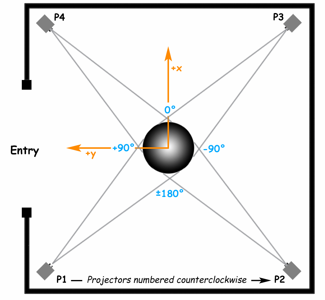
- Projectors are labeled in counterclockwise order
- Lines of latitude and longitude are included
- The center of datasets loads between P3 and P4
Data Source
Permalink to Data SourceNOAA SOS