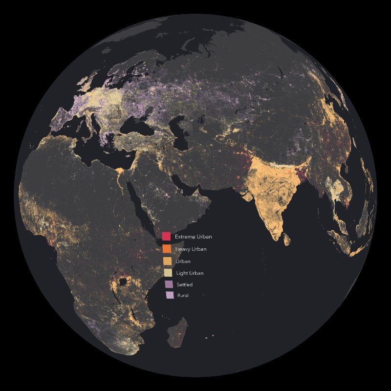
This layer is a global estimate of human population density for 2016 provided by ESRI ArcGIS. The advantage population density affords over raw population counts is the ability to compare levels of persons per square kilometer anywhere in the world.
Esri calculated density by converting the the World Population Estimate 2016 layer to polygons, then added an attribute for geodesic area, which allowed density to be derived, and that was converted back to raster.
This layer is primarily intended for cartography and visualization, but may also be useful for analysis. The colorbar gives breaks for the classes at the following levels of persons per square kilometer:
100 - Rural (3.2% [0.7%] of all people live at this density or lower)
400 - Settled (13.3% [4.1%] of all people live at this density or lower)
1,908 - Urban (59.4% [81.1%] of all people live at this density or higher)
16,978 - Heavy Urban (13.0% [24.2%] of all people live at this density or higher)
26,331 - Extreme Urban (7.8% [15.4%] of all people live at this density or higher)