Earth is like a giant magnet with a North and South Pole. However, the magnetic North and South Pole are not aligned with the Geographic North and South Pole. The Geographic North Pole is defined by the latitude 90° N and is the axis of the Earth's rotation. The Magnetic North Pole is where the Earth's magnetic field points vertically downward. The Earth creates its own magnetic field from the electric currents created in the liquid iron-nickel core.
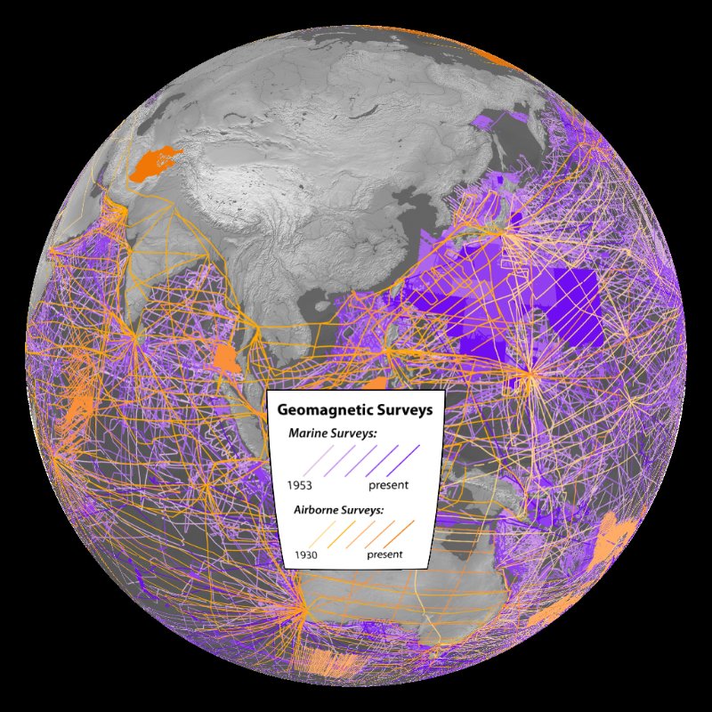
Magnetic north changes with time. In order to know where magnetic north is at different times in history, trackline data are collected every few seconds or minutes as a ship or aircraft travels, creating a connect-the-dot of data points, as depicted in this dataset.
Each data point in the trackline data includes date, time, location, and other collected values, such as height/bathymetry, gravity, and magnetics. Over the last 50 years, thousands of marine and airborne trackline surveys have spanned the entirety of the globe, from pole to pole. NOAA's National Geophysical Data Center / World Data Service (NGDC/WDS) for Geophysics in Boulder, Colorado formats, archives, and distributes these marine and airborne magnetic data contributed by many agencies and governments worldwide.
Geomagnetic trackline datasets are necessary for the accurate modeling of the Earth's crustal magnetic field. The models NGDC produces from these data support safe and accurate ship and aircraft navigation, resource exploration, scientific research, satellite launches, and a variety of other uses. The geomagnetic models are also incorporated into smartphone compass apps so that users know where they are and what direction they are moving.